NavCloud-Keyvisual

Extended capabilities of a connected ECDIS
using ChartWorld's NavCloud.

Discover NavCloud >
A fully connected ECDIS will be at the heart of all future onboard shipping tech systems. Because no matter what voyage optimisation platforms are installed, they will all be dependent on the primary requirement of safe and accurate navigation.

There is a clear demand for increased onboard bandwidth; like it is onshore, this will become a commodity in the shipping sector in the upcoming years.

High speed connectivity will significantly change the operational procedures on-board of seagoing vessels. Central to these changes will be navigational procedure and ship-shore communication.

Previously isolated ship systems will become integrated into a company’s shore-based organisation; this will change how vessel crews and the shore-based staff cooperate.

With connected systems it will be possible, at any point in a ship’s voyage, to request and receive navigational data, monitor a ship’s current position along the planned route, update weather forecasts into the route plan, and update port-arrival time.

This will lead to higher transparency of the crew’s navigational performance and allow for instant insights and onshore alerts in relation to critical situations. It will also ensure that a vessel is compliant underway when it comes to local and international regulations.

Ship-shore data analytics may also lead to improved navigation procedures and corresponding crew training programs.

Finally, connected systems will allow shore-based experts (even OEMs) to check data, which may prevent equipment failures; in this way, systems at risk can be swapped or maintained in good time, during the next call at port.

Webinars

Voyage Planing Excellence with MyRA

Feb 21th, 2024

eGlobe ECDIS
Compliance with OCIMF's SIRE 2.0

May 18th, 2022

CIO+
Compliance with OCIMF's SIRE 2.0

June 1st, 2022

MyRA & MyFLeet
Compliance with OCIMF's SIRE 2.0

June 15th, 2022

Extended Capabilities of Connected ECDIS

A connected ECDIS has additional value since its sends and receive data, either permanently ("online ECDIS") or on demand at manual or automated sequences.
    • A real time tracking of the vessel along the route (or especially outside the planned route; alarm triggering!) could be established, updated charts or weather could be considered in the actual voyage to prevent delays or damages on ship and cargo, changed Routes and Voyage Plans can be exchanged with interested stakeholders and recommendations for voyage details could be received, updated plans sent.
  •  
    • Inbuild system diagnostics data may be send to the service partner or manufacturer to ensure preventive maintenance before failure of this critical system.
  •  
    • Remote diagnostics are possible, allowing the ECDIS OEM to "dial in" your ECDIS on-board, fixing issues or update faulty software or to restore a crashed application.
  •  
    • Even online training can be imagined, when the operator may have difficulties to understand the operational procedures of the ECDIS in front of him.
  •  
    • Shore-based personnel may supervise and check compliance in regards to the Voyage Plans (Due diligence), the ENC inventory, electronic publications and to check any claims referring to breaching regional regulations like Environmental Protection Areas (EPA).

Additional Information

ECDIS general capabilities
As we need to start by looking at the basic capabilities of an ECDIS, we can identify the following main functionalities:
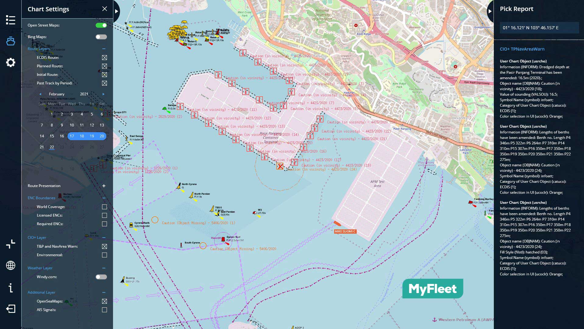
        - Maritime spatial data display
        - Safe Passage Planning (Appraisal)
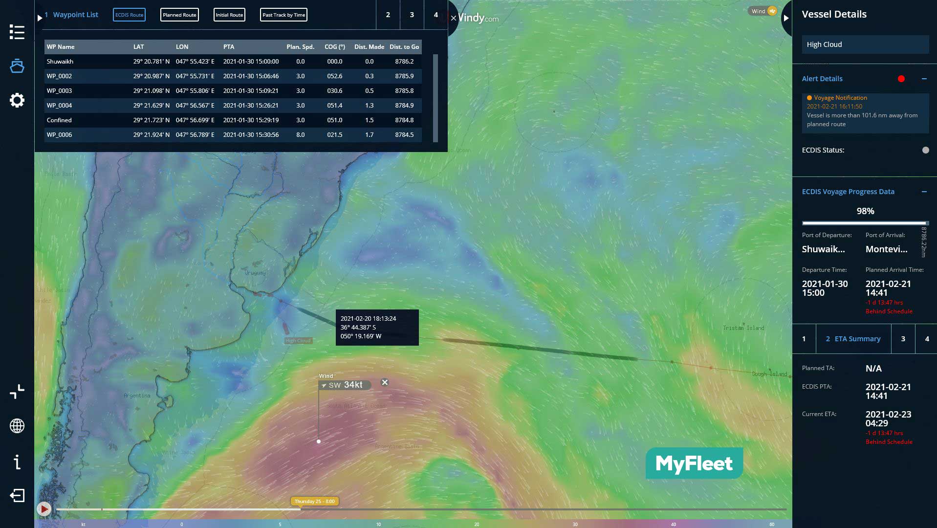
        - Visualization of route and voyage
        - Anti-grounding capability
        - Monitoring of position and of surrounding target (AIS and radar)
        - Monitoring and display of navigational sensors
        - Visualization of warnings and temporary changes (Navtex, NtM, information overlays)
        - Chart-update management and control
        - Track recording
        - Alarm management
In summary: an ECDIS is a planning, visualization and decision-support system, which (in competent hands) improves the safety of navigation.
Cyber security
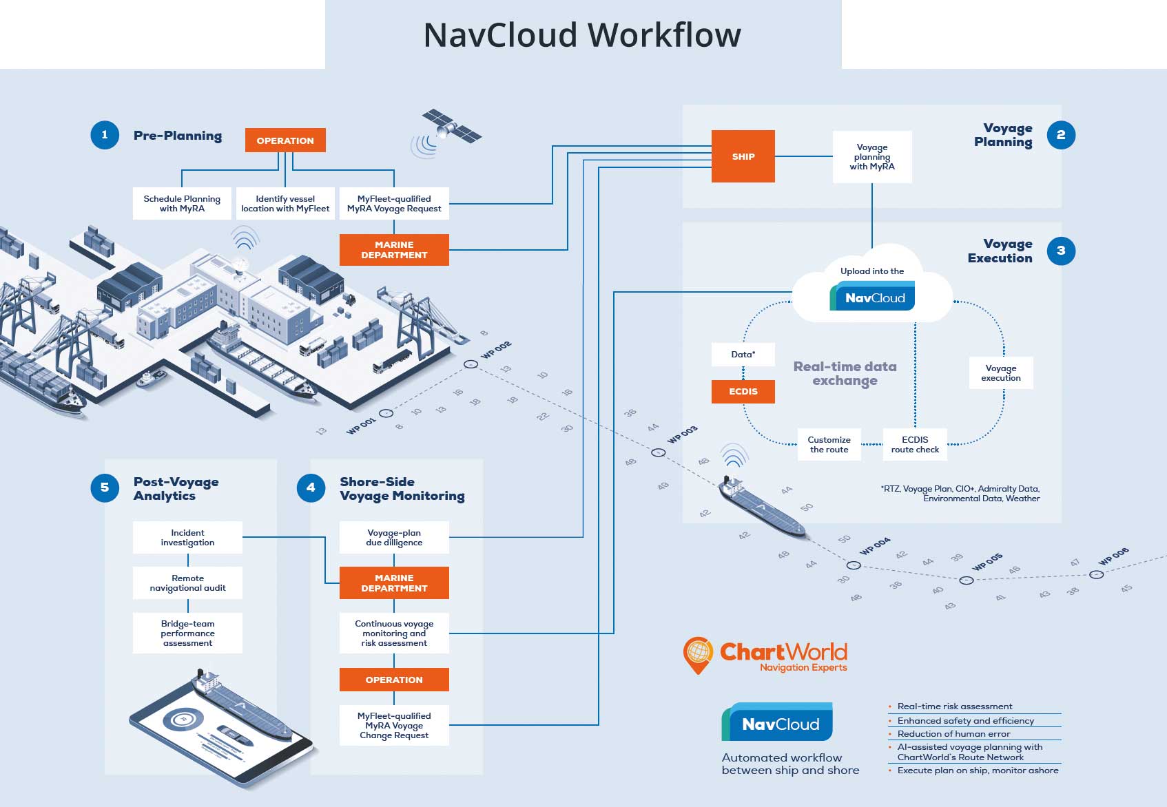
The transfer of content from one source media to a target machine remains the most critical process with regard to IT security and system integrity.

The risk that a USB stick, intended to be used for safe navigation, is in fact faulty and carries a virus, is a threat to avoid by every possible means. It can pose a great risk to the ship and the crew.

Therefore, if you want to connect your navigation system to a data link, you have to undertake cyber-security measures.

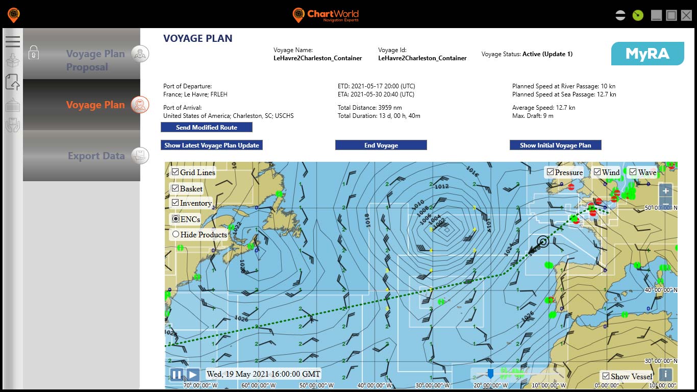
The technical way of connecting the ship’s ECDIS with infrastructure onshore is the use of Virtual Private Networks (VPN). The data exchange is then handled via a File Transfer Protocol (ftp).

You will also want to protect your ECDIS from getting infected via the ship’s communication computer (which is then acting as the media server of the satellite comms). This may be a shared computer for the tasks of email communication, social networking and other functions; so it is recommended to use a firewall to protect your vulnerable ECDIS.

The industry offers type-approved Gateways (IEC 61162-460) which will support secure data exchange between ship and shore and make the bridge “USB-free”, removing the risk of harm to system integrity.

Get In Touch

For more information and solutions on this topic,
please send us an email.

Related Product and Services

Get to know our products and services.
eGlobe
eGlobe is our type-approved ECDIS, featuring a high-quality panel display, inbuilt RAID drives, and a back-up power supply.
MyRA
My Route Appraisal (MyRA) is a digital routing service; it provides vessels and onshore personnel with a proposed ECDIS-ready voyage plan.
MyFleet
MyFleet is a web application, intended for use in a shipping companies office or by the shipping company staff at travel or at home.
chevron-down